June 8, Day 7: Cold Springs to Bob Scott Summit, NV (57.5 miles)

We were woken up by the automatic sprinklers at 8:00am and took our time on this short day. First I tried to get BBQ chicken at 9:30am, the waitress thought I was nuts. The ride was chill and the weather warm, until we got to Austin where we did a steep climb in the scorching sun to the summit. Luckily we had a lot of tailwind and it made the descent one of the craziests yet. The uphill to Bob Scott was not bad, it is a lush campsite with lots of pine trees, chipmunks, and sun. The water is also really tasty. We later took freezing cold showers under the spigot.

Total miles this week: ~439.0

20110609-060804.jpg
Beautiful, fast descent down Mt. Airy

20110609-060845.jpg
Austin

20110609-060911.jpg

Bob Scott Campground

20110609-060928.jpg

Dinner: lettuce, instant mashed potatoes with corn and beans mixed in, sardines, and tea.

June 7, Day 6: Fallon to Cold Springs Station (61.5 miles)

There ain’t nothing much between Fallon and Cold Springs Station, but that’s what made the ride so beautiful. We met a couple from the Netherlands touring from Miami to Los Angeles, who hyped up this BBQ chicken/corn on the cob/mashed potato lunch special that they had at Cold Springs the previous day. BBQ chicken became our mantra and we arrived only to find out the special was over. We settled on country fried steak and peach cobber instead. I smashed Matt in a game of pool, we met the cutest puppy ever, and camped behind the restaurant for ten bucks (showers included).

20110609-055353.jpg
Salt Wells along the 50

20110609-055505.jpg

20110609-055612.jpg

20110609-055637.jpg


making a bicycle out of rocks


the ground is smushy

tree full of shoes everyone talks about


camping behind Cold Springs Station, Utah

June 6, Day 5: Carson City to Fallon (65.5 miles)

Woke up at 5:30am to sneak out of the RV park and save $35. It was downhill in the rain most of the way (we didn’t do all that climbing for nothing). Washed and dried our clothes, ate at a dive called Jack’s and… That’s about all there was to do.

20110609-054559.jpg
We asked some locals for directions and all we could understand them saying was “Nugget.”

June 5, Day 4: Cook’s to Carson City (79.5 miles)

20110609-051138.jpg
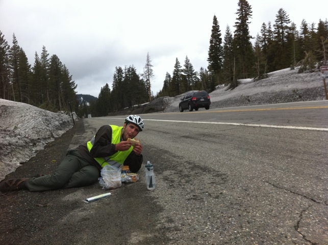
PB&J break near the Mormon Emigrant trail and a truck looming in the background ready to plow through the shoulder.

20110609-051343.jpg
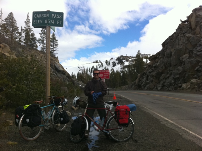
FINALLY atop Carson’s Pass.
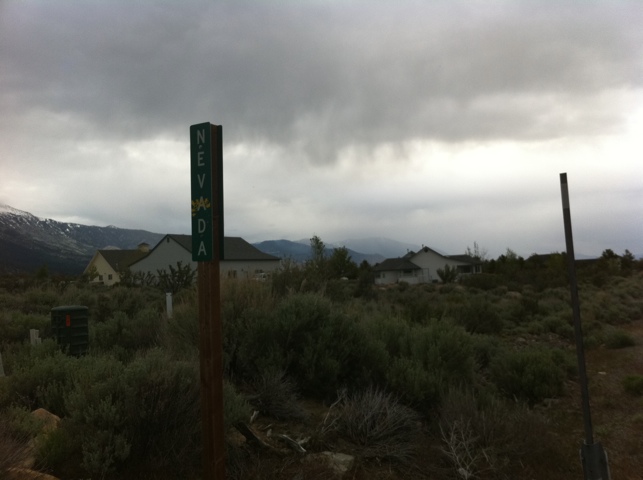
20110609-053003.jpg
Nevada border

Cook’s is definitely haunted. I totally got woken up by a ghost in the middle of the night moving tubs around the restaurant before the owner told us it was haunted the next morning. We had sausages, eggs, and potatoes and headed out for the second part of climbing of the Sierras (34 miles).

It was pretty tough, but the descents were pretty gnarly. Freezing rain hitting you as you go downhill 37 or so miles per hour is painful and blinding. The final descent down Carson’s Pass lasted about 40 minutes — you go so fast that at some points you just want it to end.

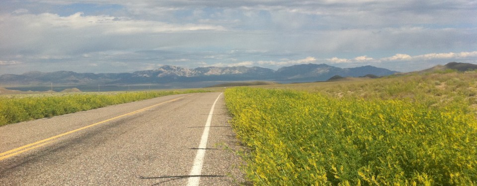
Coming into Nevada we got on our favorite road so far while touring: Emigrant Trail which turns into Foothill Rd. It was the smoothest and most scenic downhill ever. We dubbed it The Chillest Road in America.

And then it started pouring. We ended the day with Double-doubles from In-n-Out and squatted at an RV park in Carson City.

Update with some more photos:

Let’s be safety.

We got hit with freezing rain on this descent. We didn’t have our gloves on at the time either. It hurt like crazy.

Carson’s Spur, avalanche area. We thought this was the summit!


Nevada.

Matt’s camera died shortly after this photo was taken as we got caught in heavy rain that lasted throughout the night. More photos that were taken on the camera I bought later during the trip to come.

June 4, Day 3: Folsom to Cook’s Station (62.5 miles)

20110609-052737.jpg

The next morning. Burrrr.


Today was crazy. The rain was not so bad but it was freezing cold. I got two flats — the first from a tiny cut in my tire and the second from not catching it the first time. Patched it and made it to Placerville where we got a much needed hot chocolate. From there on we started climbing up into the Sierras. the steep winding climb took forever. We ran into the cook from Cook’s Station along the way and at first thought we were about to get murdered. After flooring it passed us on the desolate Omo Ranch Road, he breaked and reversed unexpectedly to talk to us. Matt pulled out the pepper spray as a precaution, thinking it was some Wrong Turn shit. Anyway he was very nice and so was his creepy vintage Ford F-150. We arrived at Cook’s an hour after nightfall, set up camp in the back, warmed up chili and crawled into the tent.


June 3, Day 2: Lake Solano to Folsom Lake (64 miles)

On the way to Davis, CA

20110609-050200.jpg

20110609-050226.jpg

20110609-050249.jpg

Turkey friend.

We didn’t get much sleep but seeing huge peacock in the tree evened things out. Rode 13 miles to Davis to see Willy off at the Amtrak station (thanks for breakfast!). The rest of the ride was a calm cruise down the American River Trail bike path to Beal’s Point Campground in Folsom. We had curry for dinner and knocked out at 8:30pm. Highlight: seeing a bunch of turkeys all day.

20110609-050745.jpg